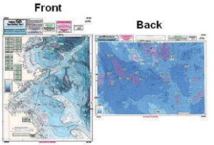
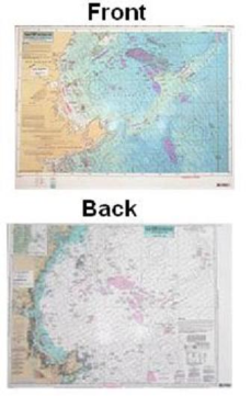
Bathymetric – color contoured by depth – double sided, laminated, 19 x 26 inces, Massachusetts Bay area
Nearshore Bathymetric Chart side A: Isle of Shoals, New Hampshire to Duxbury Beach, MA, east to Wildcat Knoll with Stellwagen Bank. Side B: Wildcat Knoll to Wright Swell, north to Cashes Ledge to Franklin Swell. All charts include GPS coordinates, wrecks, reefs, shoals, fishing areas, amenities and restrictions


Reviews
There are no reviews yet.