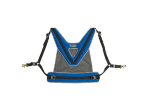
AFTCO MAXFORCE II SHOULDER HARNESS
September 9, 2014
CAPTAIN SEAGULLS CHART GMM17, GULF OF MAINE & MASSACHUSETTS BAY CHART
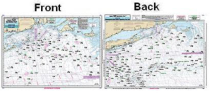
September 10, 2014Offshore chart off MA, RI, CT, NY, & NJ, 90 to 100 miles off coast, Double sided, laminated, 19 x 26 inches.
Front: Nantucket Shoals to tip of Montauk, NY, south to cover all canyons beginning with the Veatch Canyon. .
Back: Extends from Montauk to Five Fathom Bank off Cape May, NJ. This chart has sister charts the ONJ19 and ONY59. All charts include GPS coordinates, wrecks, reefs, shoals, fishing areas, amenities and restriction


Reviews
There are no reviews yet.