CAPTAIN SEAGULLS CHART IC209, STELLWAGON BANK TO WILDCAT/CASHES LEDGE
September 10, 2014CAPTAIN SEAGULLS CHART BKL207, BATHYMETRIC NEARSHORE BLOCK IS. SHELF AND COASTAL NY AND NJ
September 10, 2014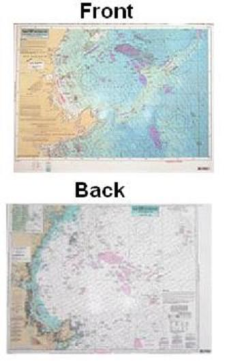
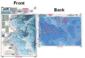
CAPTAIN SEAGULLS CHART CA201, BATHYMETRIC CAPE ANN TO JEFFREYS LEDGE
$21.99
Bathymetric – color coded by depth – double sided, laminated, 19 x 26 inches, North Shore, Massachusetts
A detailed chart color coded by depth on one side and a regular NOAA chart on the other side. GPS coordinates on all fishing spots. From Cape Ann, MA off shore to Jeffrey’s Ledge.

Reviews
There are no reviews yet.